Monitor areas of interest, validate information on the ground, and discover trends relevant to your industry. Access and analyze daily, global imagery and deep historical data through the Planet Platform
Planet Monitoring
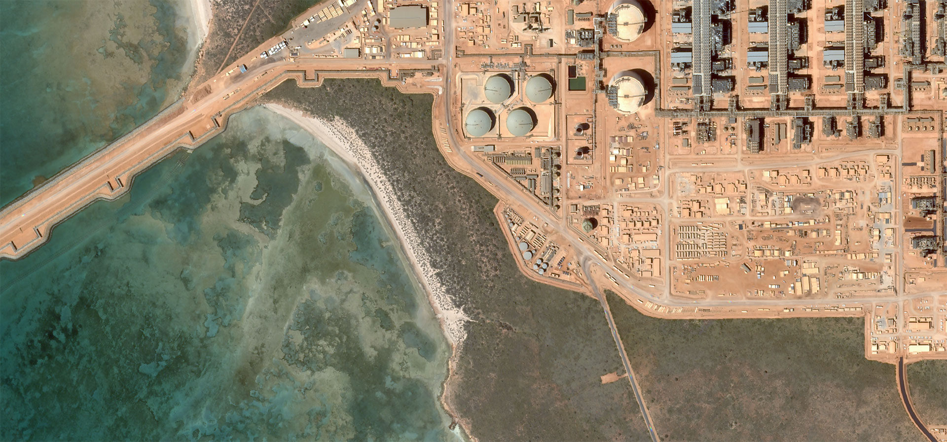
With 120+ satellites in orbit, Planet is able image anywhere on Earth daily at 3 meter and 72 centimeter resolution. Monitor your areas of interest, discover patterns, and deliver timely insights.
With near-infrared, and video capabilities, Planet’s SkySat fleet can image any point on Earth at 72 cm resolution up to twice-daily – higher revisit than any other commercial hi res imagery provider.
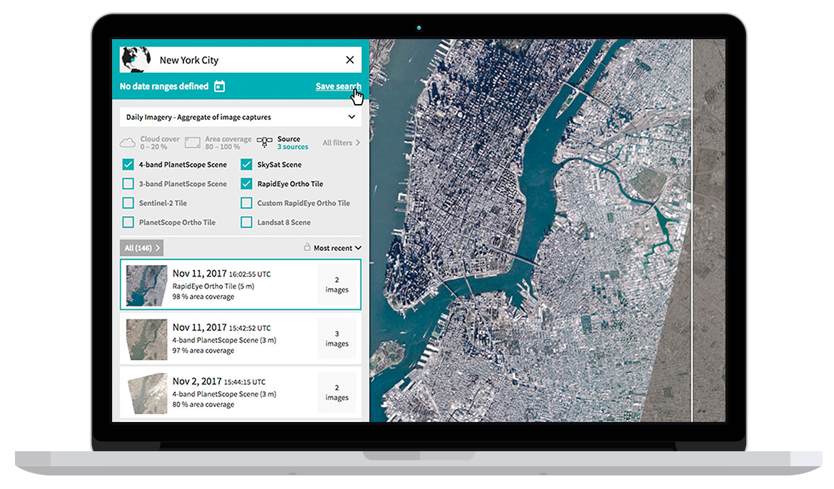
Explore daily imagery directly in your browser. With search, metafilters, and a timeline axis, Planet Explorer is an easy GUI tool you can use to view imagery, prime analysis, and see the planet change over time.
Built for speed and affordability, the Planet Platform makes it easy to build tools, ingest imagery, and run analytics at scale. Our platform downloads, processes, and manages 6+ terabytes of data every day.
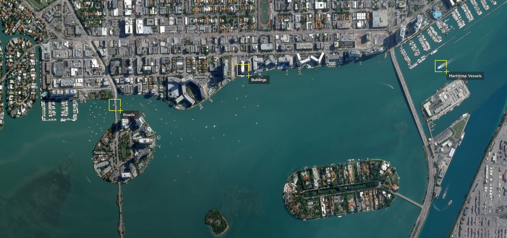
With an industry-leading combination of coverage and cadence, we deliver medium and high resolution Earth imaging data at unprecedented scale. Identify, monitor, and predict change with daily imagery and an 8+ year archive for model training and analysis.
Update your products and analysis with recent and visually-precise Basemaps. Planet’s frequent daily, global imaging creates the most complete and current Basemaps available, customizable by area and time of interest.